|
|
|
|
|
|
|
Little-known, and seldom-visited Ribbon Falls, located in Yosemite National Park, is the longest single-drop waterfall in North America. The falls drop an amazing 1612 feet, according to every source I've seen. Who has the courage to measure something like this? Unlike Yosemite and Bridalveil falls, there is no "formal" trail to the base of Ribbon Falls, yet there is in informal trail, which until this posting, nobody has posted GPS coordinates, for the convenience of those who want to make the hike to visit this amazing waterfall...
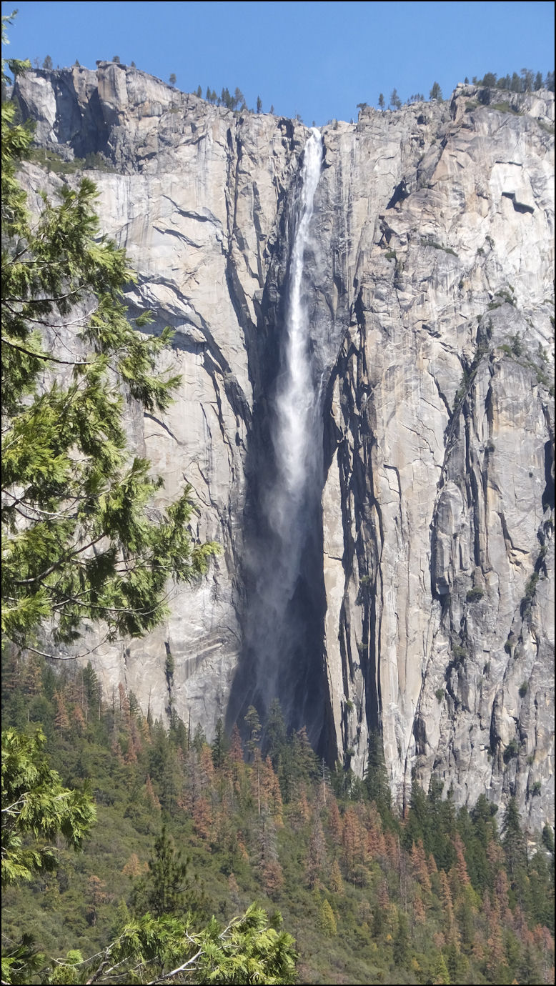
Photo: Ribbon Falls, as photographed across Yosemite Valley, near the more visited Bridalveil Falls on Wednesday, May 04, 2016. Ribbon Falls is the highest, single-drop water fall in North America, yet it is seldom-visited, as it's seasonal - fed only by melting snow - and there is no "official" trail to the base of it, as exists with it's more famous siblings, Yosemite and Bridalveil Falls. Actually, it seems the National Park Service is "hush-hush" about how to hike to the base of Ribbon Falls, as are most of the major conservation groups. It almost seems as if the base of Ribbon Falls is a secret. Fear not, and read on, as I'll reveal GPS coordinates, and the fact that a trail to Ribbon Falls really exists.
Photo: It's about 11:00 in the morning on Tuesday, June 11, 2019, and my brother Michael, brother-in-law Greg and I are going to take another hike to the base of the majestic waterfall, which is the longest single-drop waterfall in North America. As you read this article, you'll note quite a variation in the flow of the waterfall. Ribbon Falls is a "secondary" waterfall, as it's source is 100% snowmelt, and it usually dries up in mid-June to mid-July, depending on the snow pack. During the winter of 2019, the Sierra Nevada mountain range receive a great snow pack, so on this mid-June Tuesday, Ribbon Falls was flowing strong. If you're considering hiking to the base of the waterfall, please read the complete article for the trail description, trail particulars, etiquette, and most importantly SAFETY. Nothing about the trail has changed over the years, but the parking, the duck, or more properly referred to as a cairn that marks the start of the trail is frequently demolished or non-existent, thanks to the efforts of the Park Service, who doesn't exactly seem to welcome activity on this trail. You WILL NOT find this trail marked on any Park Service maps, nor will any employees tell you anything about this trail. However, there is NOTHING ILLEGAL about visiting the base of Ribbon Falls, and the Park Service won't hinder you in any way, as long as you adhere to the rules of the Park Service, and Yosemite National Park. The Park Service just wont' tell you anything about this amazing trail... OK, now let's get to the latest updates...
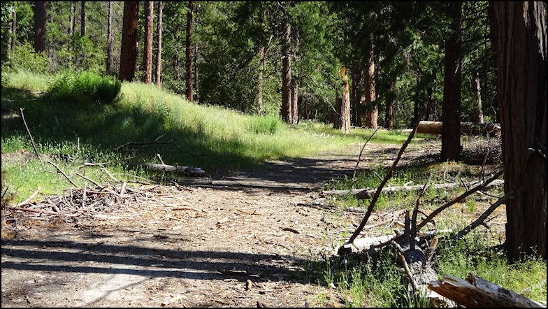
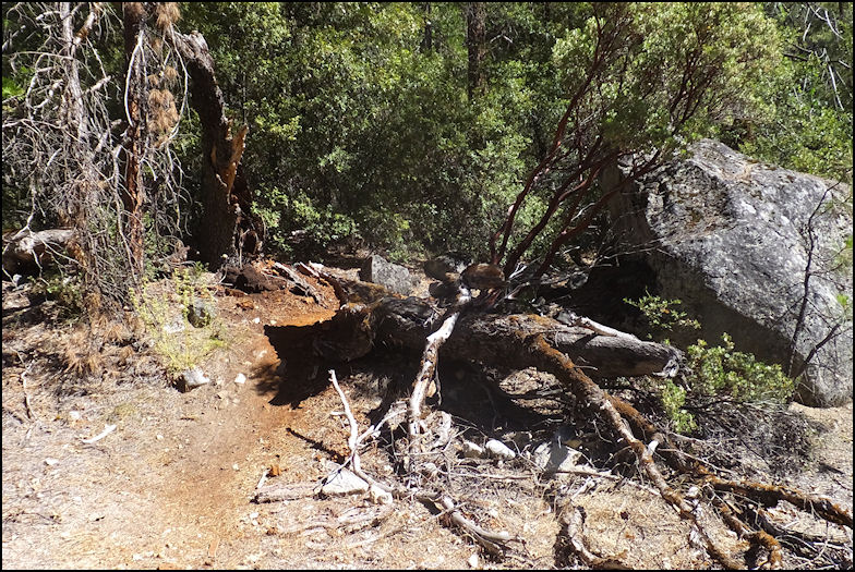
Photo: Ribbon Falls is located on the north side of Yosemite Valley, about a mile west of El Capitan. To get to the turnout, you drive west on Northside Drive, also know as CA 140, passing massive El Capitan. Look to your right, and about a mile west of El Capitan, you'll begin to see water; this is Ribbon Creek. There are several branches, but slow down, be in the right lane, and after you cross several branches of the creek, you'll see a turn-out - not a parking lot - where there is room to park four or five vehicles. You'll also notice logging activity, and a big pile of logs, and lots of logging slash and debris. Park here, as you've arrived at the beginning of the trail. The locked gate is gone, but you note a muddy road, which will begin your hike. Hike about 100 yards up this road, always staying to your right, and you'll come to what once was the Big Oak Flat Road, which was re-routed years ago, and the right-of-way is slowly being reclaimed by the forest. Hike this road a 100 yards or so, and you'll come to the trail to Ribbon Falls. The photo shows how the once Big Oak Flat road looked on our June 11, 2019 visit.
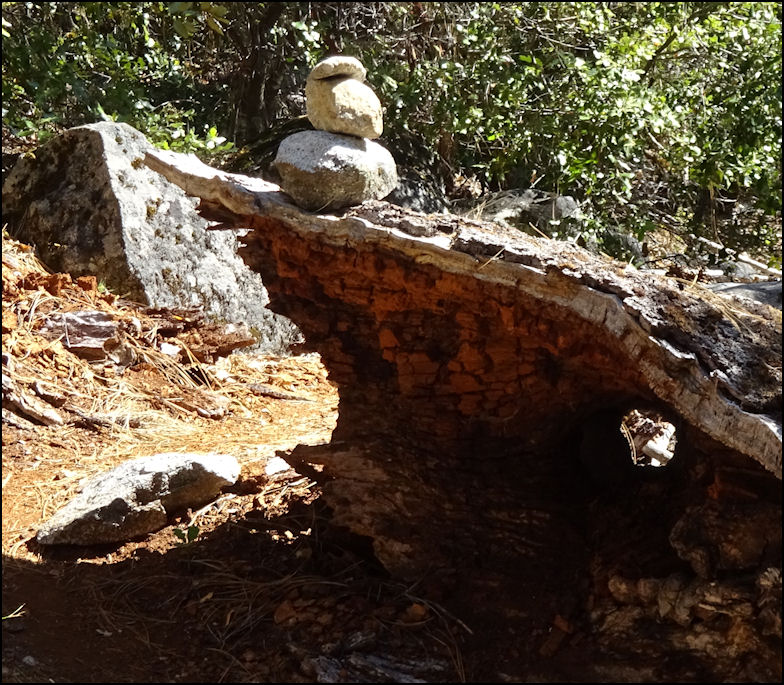
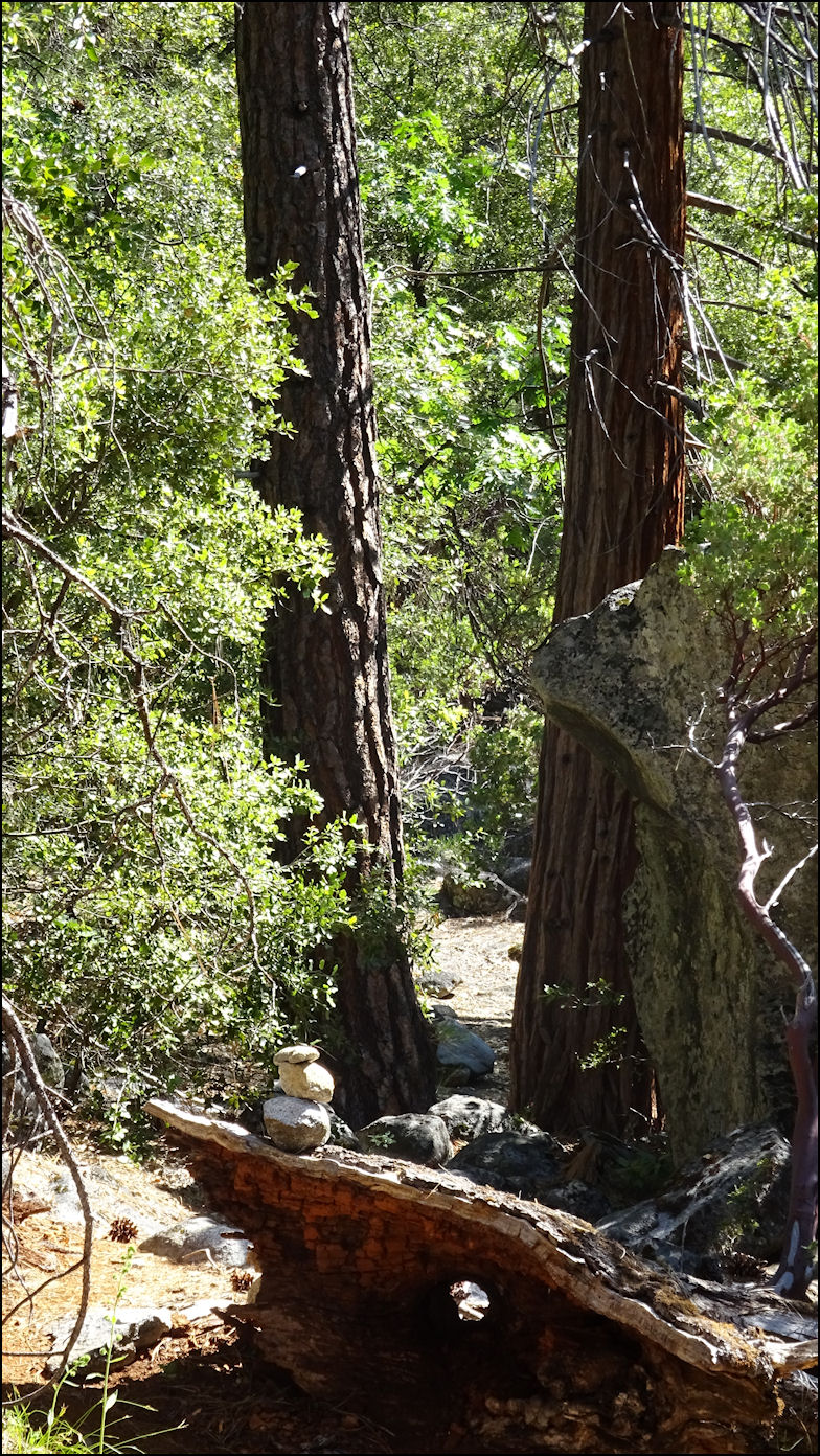
Photo: The duck, or rock cairn, rests on a fallen sugar pine trunk, which marks the beginning of the trail, which is all uphill. If you brought your GPS - smart idea - the coordinates are N37.43.549, W119.38.730. The GPS coordinates won't change, but don't count on the cairn, as the Park Service seems to like to remove it every time one of their employees is in the area. Don't ask my why...
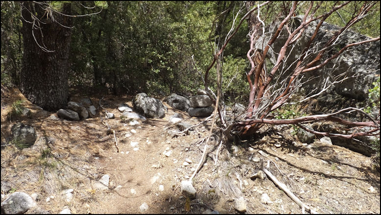
Photo: The rock cairn and the two forked trees mark the beginning of the trail. If you haven't brought your GPS - why didn't you? - and the rock cairn has disappeared, look for these two trees, as they are distinctive, and there are none others formed like this in the area. You're ready to begin your hike to the base of Ribbon Falls. You've got a hike of 2.51 miles each way, with an elevation gain of 1158 feet. It's all uphill, and much of it is steep, such as 45-degrees or more, with some minor scrambling. Plan on a little over two hours to go up the trail, and an hour to head back down. The trail is on the difficult side, so take all precautions. Even though the trail largely pararrels Ribbon Creek, bring plenty of water, as access the creek is both difficult and dangerous.
Photo: About half way up the trail, you'll begin to feel the cooling effects of the water, which is a good thing, as the temperature is frequently over 90 degrees. This photo was taken about a half mile from the base of the falls, and the mist really felt wonderful on this hot, early afternoon in June.
Photo: How many ways can you say SPECTACULAR? This was as far as we hiked, which is probably about 200 yards from the base of the falls, and the 180-degree grotto that encapsulates the falls. From our vantage point, we looked up at the roaring, thundering falls, and simply gaped, and were amazed at God's, and natures beauty. Yes, we got drenched, which felt both refreshing and wonderful, since it was a hot, 2-hour slug up the trail to get to this spot. No worries, as by the time you get back to your car, you'll be dry. Enjoy your hike. Be sure to read the rest of this article, as I've written detailed accounts of the trail, which never changes. So now let's go back and visit a couple of our previous hikes to Ribbon Falls... Note that nothing has changed about the trail except for the area around the turn-out where you park, and the rock cairn that marks the trail head tends to change dramatically. The two sugar pine trees that mark the beginning of the trail are alive and well, and happy to point you to the start of this marvelous trail. Photo: Update to Wednesday, June 20th, 2018. The Park Service has removed the carin, but the trail is familiar and unchanged since out last visit, a little over 2 years ago. The GPS coordinates haven't changed, as the trailhead is located at North 37.43.549, West 119.38.730. For unknown reasons, the Park Service doesn't seem to want anybody to visit the base of Ribbon Falls. For your safety, read the tips I've posted at the end of this article.
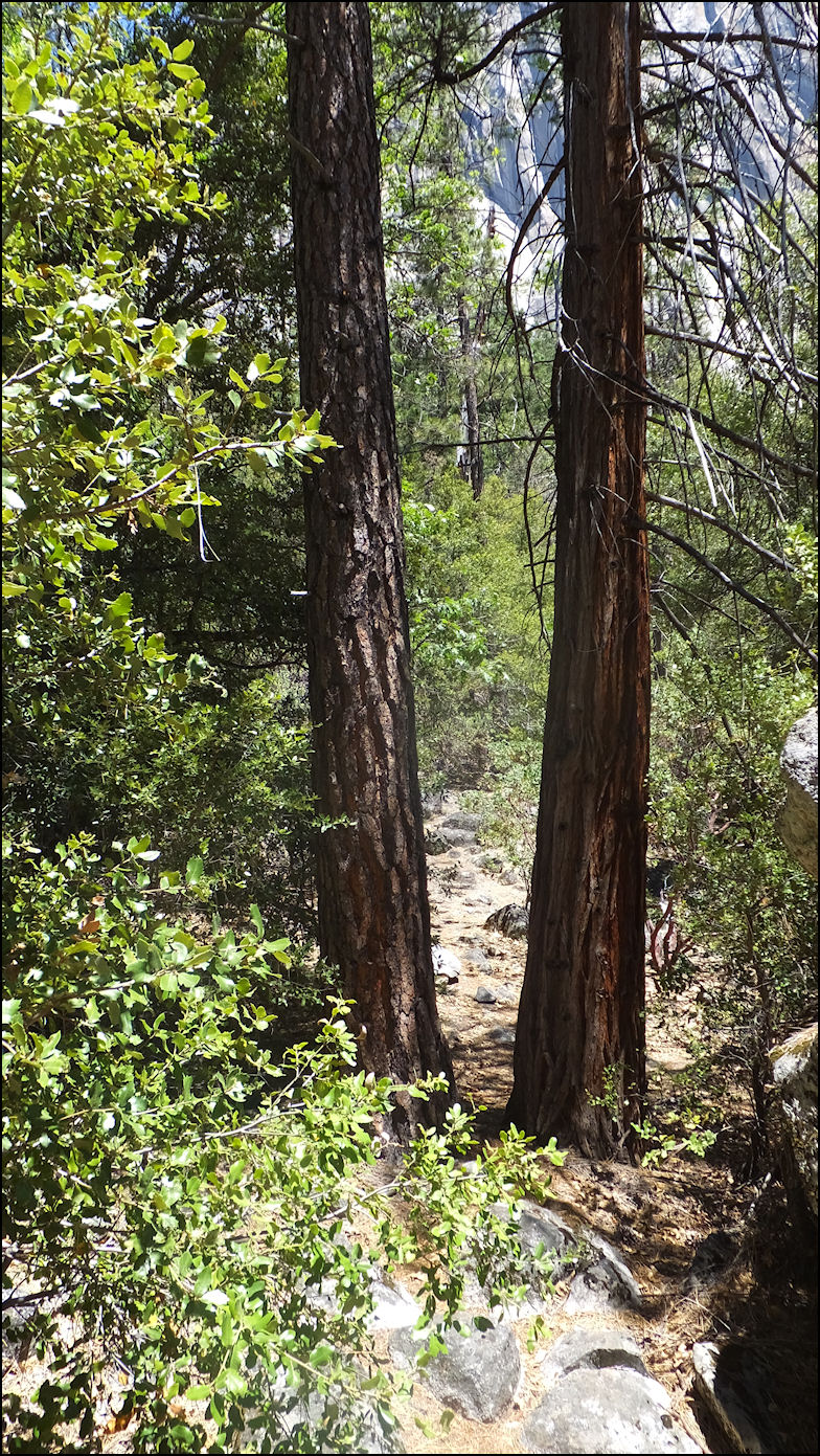
Photo: About 50 feet from the beginning of the trail, if you've managed to find it, the trail passes between two very tall sugar pines. You can't miss this... Pass between the two tall trees, you're on the trail, and you have around 1100 feet of elevation to gain, and just less than three miles until you're at the base of Ribbon Falls.
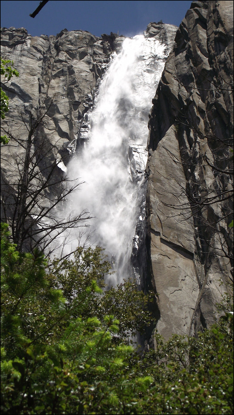
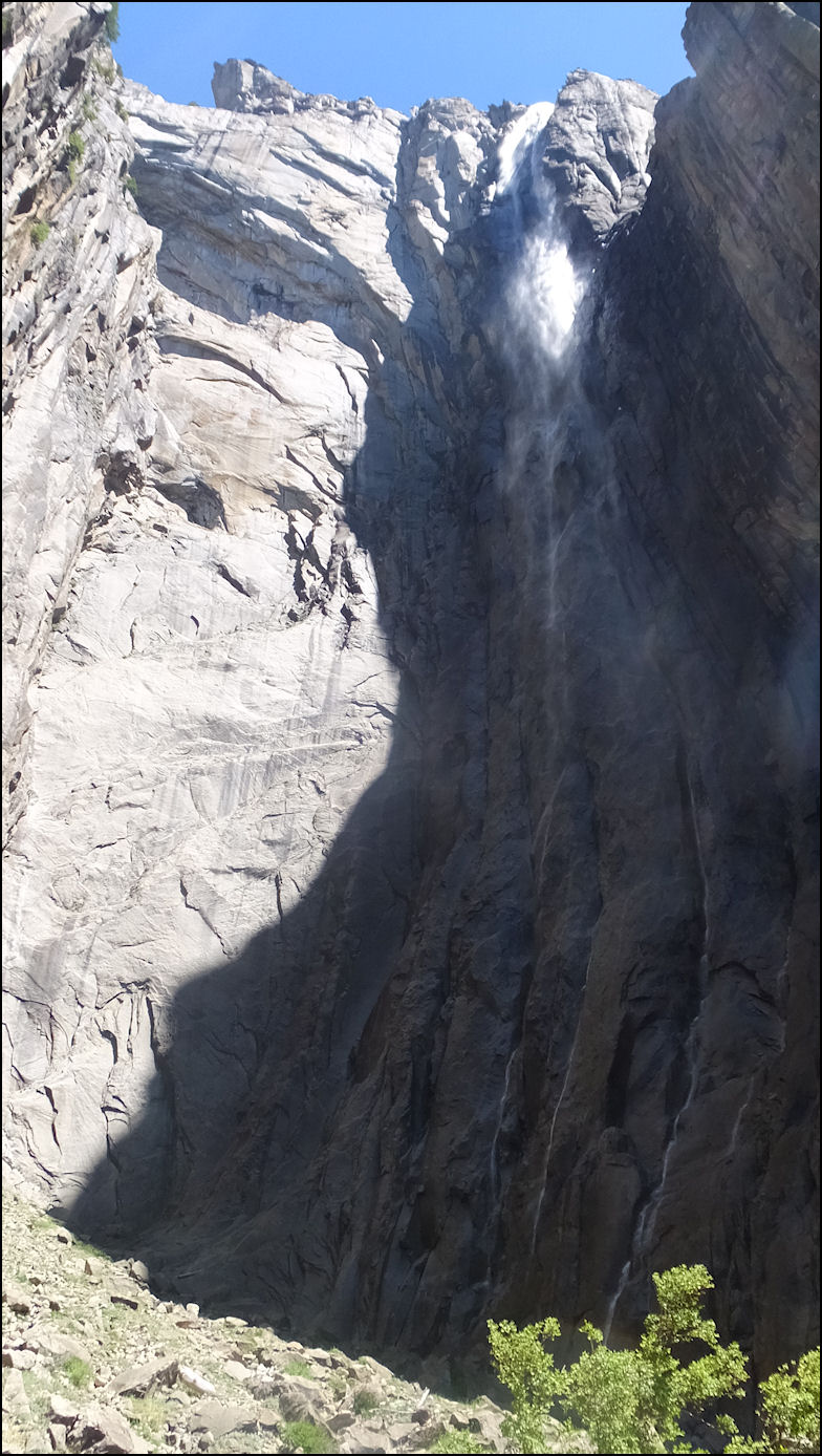
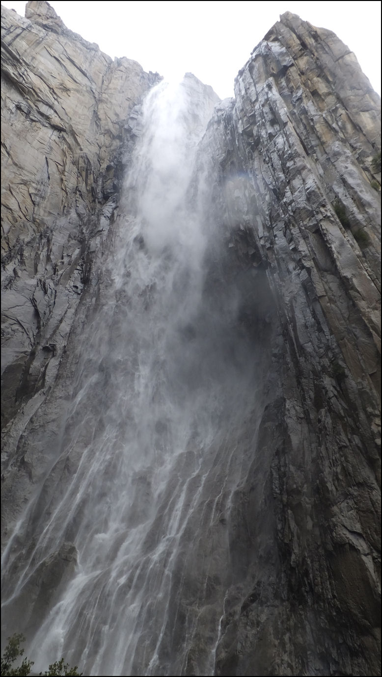
Photo: The view at the base of Ribbon Falls is simply AMAZING! The photo doesn't capture the totality of the view, but you've got a half-circle of solid granite, 1000-plus feet high, with the waterfalls going down the rock and splitting into three branches. Even on this late June afternoon, there is a cool mist from the falls, as it makes it's own micro-climate.
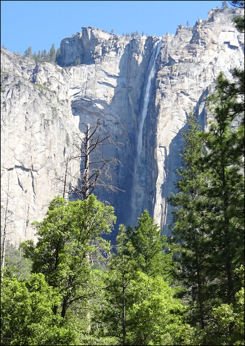
Photo: It's late June, and the water is still flowing at the top of the falls! Despite the fact that Ribbon Falls is little-known, and the Park Service discourages hiking to the base, the moderate hike is worth the effort, and even on this hot - 95-degree - June afternoon, a cool mist blows from the falls. Looking up at the 1000+ foot drop leaves you in awe of God's glory. Ribbon Falls is fed by snow melt water, and we were totally surprised that this much water was flowing on this late Wednesday in June. Let's go back to Wednesday, May 04, 2016, when my brother and I hiked Ribbon Falls for the first time, when there was much more water flowing...
Photo: The trailhead to Ribbon Falls, as of Wednesday, May 04, 2016, with the rock cairn to the left, the informal trail in the center, and the large manzanita bush to the right. So you want to hike to the base of Ribbon Falls? If you'll do, you'll be a fraction of a percent of the millions of folks who visit Yosemite National Park every year, and it will give you new awe of the amazing beauty this seldom-visited part of Yosemite Valley offers. Ribbon Falls is located just west of the monolith El Capitan. In fact, as you head west, pass El Capital meadows, where you'll probably notice many tourists photographing mountaineers climbing the famous rock, and drive about a quarter mile to the right. You'll see a small, dirt parking lot on the right, with a most always locked gate. This is where your hike begins. Park, lock your car, and if you're cautious, enter it as a waypoint on your GPS. You start your hike at the locked gate, which is access to a woodcutting area, that occasionally the Park Service authorizes for use. Note the fact that you are just west of Ribbon Creek - the creek is to your "right" - and you'll be paralleling Ribbon Creek all the way to the base of the falls. Begin your journey by heading up the once-paved road - which was actually the grade of the original Big Oak Flat Road - and hiking about 1/4 mile to the trailhead. The trailhead, which appears in the above photo, is located at North 37.43.549, West 119.38.730. The elevation is 4121 feet. As the photo shows, look for a large manzanita bush, a rock cairn, and a faint trail. However, due to the efforts of the Park Service, and others who want to keep this trail a secret, don't count on a rock cairn. But my GPS coordinates are accurate, and they don't lie.
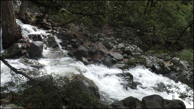
Photo: Ribbon Creek, tumbling down the steep grade, about a half mile from the trailhead. There IS a trail to the base of Ribbon Falls, and it is not difficult to follow; it fact, it's almost easy. It isn't paved, it isn't graded, and there are no signs to guide you. After you leave the trailhead, as seen in the previous photo, just follow the informal, well-worn trail, which is clearly visible about 98% of the way to the base of the falls. There are stategically placed rock cairns to guide you. If by some slight chance you lose the trail - highly unlikely - just head uphill, and keep Ribbon Creek within listening distance, and within seconds, you'll see the trail or a rock cairn. The trail is moderately strenuous, and you must be able to scramble up rocks, and to be able to keep your balance. From the trailhead to the base of Ribbon Falls, we measured the distance as 2.51 miles, with an elevation gain of 1158 feet. My brother and I are both in our early 60's, and it took us 2 hours and 5 minutes to hike from our parked car to the base of Ribbon Falls, with frequent rest stops. The informal trail is steep, but I would only rate it with a moderate difficulty, as there are no drop-offs, and the distance is only a couple of miles and change, and there are no real dangers, as long as you are careful. Bring mosquito repellent, as those guys will find you, along with gnats. They don't discriminate, so no matter who you are, you'll be their lunch, unless you take precautions. You can drink out of Ribbon Creek, but you must treat the water. Back as a kid in the 1960's, we drank out of every creek and spring in Yosemite, but sadly, in 2016, you MUST treat the water before drinking it, otherwise, you'll dearly pay for it later.
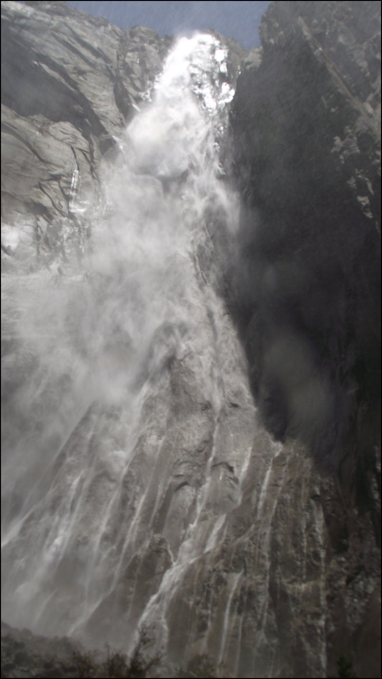
Photo: We're at the base of Ribbon Falls, looking up. Due to the immense height of the falls, the photo doesn't show it all, nor can the photo show the amazing beauty of this unique waterfall. The base of Ribbon Falls has been described as an amphitheater, as the water falls into sort of a rock bowl, as it falls down the mountain. Words can't describe this amazing sight! I've visited many waterfalls in Yosemite, but there is nothing like Ribbon Falls. Enter these coordinates into your GPS: North 37.44.034, West 119.38.892. You're at elevation 5298 feet, and you've climbed 1158 feet in 2.51 miles. Congratulations!
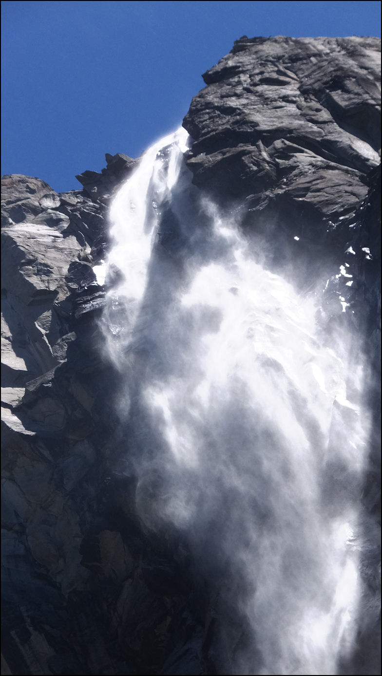
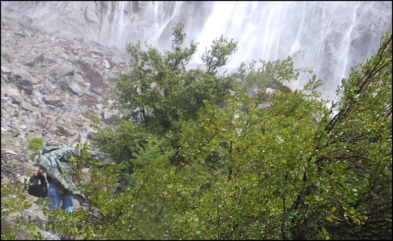
Photo: My brother, Michael, scrambles, as he battles the wind, and the mist, at the base of the waterfall. The waterfall creates it's own weather, as wind swirls at the base, and the mist produces monsoon-like rain. Since the waterfall is fed by melting show, the water is COLD, along with the air temperature at the base of the falls, and unless you're dressed correctly, hypothermia is a real possibility. Michael and I both donned waterproof panchos as we approached the base of the falls. We only stayed at the base of the falls for a few minutes, due to the swirling wind, and the freezing mist, which pounded us like rain. Between every photo, I had to clean the lens of my camera, thanks to the heavy mist. Due to safety concerns, including the real possibility of falling to our deaths on the slippery rocks, and the freezing, cold water, we didn't get any closer to the base of the falls than where this photo was taken, which is probably about a quarter mile from the actual base of the falls. To get to the base of the falls, we would have had to cross the alluvial fan, which consists of slick boulders, most of which are the size of a basketball, but there are many that are much larger. In my opinion, it would have been suicide to get any closer, and due to the freezing "rain," it would have been very uncomfortable.
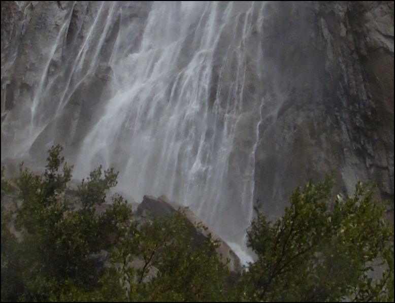
Photo: Michael and I were amazed the way the falls separates at the base, before all of the water is funneled into the creek. The water is separated into many small streams, as each one follows a crack in the granite rock. It's amazing, and definitely a tribute to the wonder, and the beauty of God! Here are a few facts you may find useful if you plan on hiking to the base of Ribbon Falls: * Round trip is about 5 miles Ribbon Falls is breathtaking and amazing, and if you want to hike off the beaten path in Yosemite National Park, a hike to Ribbon Falls should be on your to-do list. Copyright(c) 2019 eRench Productions, Inc. All rights reserved. We've been on the web since December 22, 2002.
|