|
|
|
|
|
|
|
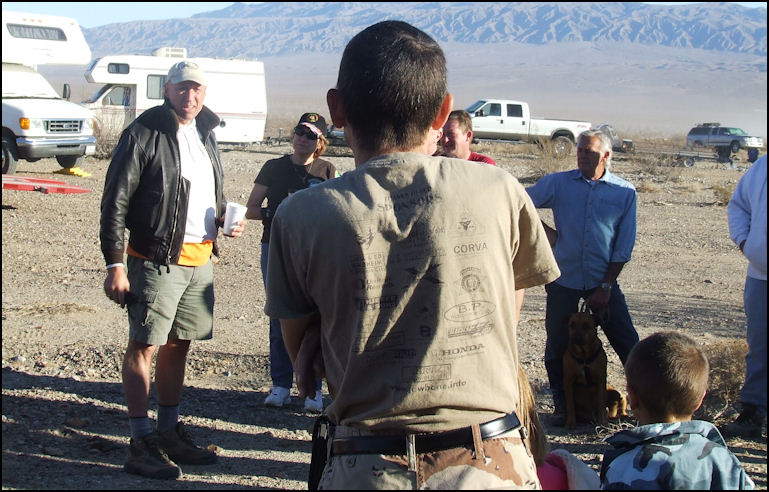
After the problems that I encountered on yesterday's run to Lookout City at the small waterfall, I was looking for a easy, scenic run, and the Back Door To Darwin Falls run seemed to meet that criteria, as the trail difficulty rating was only a three, on a scale of 1 to 10, according to the run board posted in base camp. So Saturday morning, November 8, 2008 at 07:30, found me in the driver's meeting for the day's run listening to the trail boss, Russell Traughber explain the day's activities. Russell stressed that if you were looking for excitement and challenges, that this run wasn't for you, as it was to be an easy, scenic run, that was suitable for any stock four wheel drive vehicle. It sounded exactly like the sort of run that I was looking for...
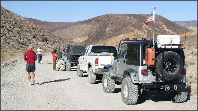
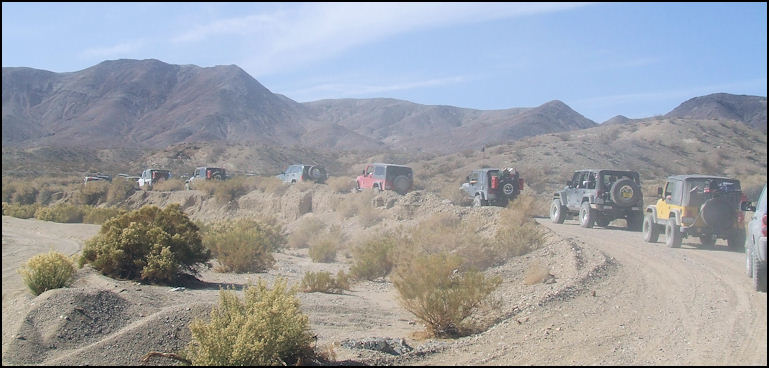
Photo: Our trail boss, Russell Traughber at the left of the photo, goes over the day's activities at the driver's meeting. Fun and safety are emphasised during CA4WDC events. The run left base camp at eight o'clock, on that sunny Saturday morning, and headed east on the washboarded Slate Range Road. After enduring the three miles of dust and washboard, we headed north on the paved Panamint Valley Road, which runs down the center of the valley. After about 10 miles or so, you'll see a sign advising you that you've entered Death Valley National Park, and then after a few more miles, you'll come to CA Highway 190, where Panamint Valley Road ends. We turned west on CA 190, and as we passed Panamint Springs Resort, we picked up a few more vehicles who had proceeded us, in order to fill up their tanks at the only gas station for 50 miles, and the only gas available in Panamint Valley. After leaving Panamint Springs, it was a short half mile to the Old Toll Road, which would be the start of the day's trail run. From Highway 190, the GPS coordinates for the Old Toll Road are N36.20.454, W117.29.033, elevation 2132 feet. We took a 15 minute break to allow those who hadn't already air down their tires, accomplish that task.
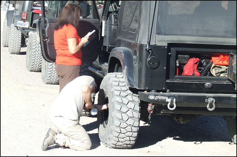
Photo: We pulled off the highway, onto the dusty Old Toll Road, to allow those who already hadn't done so, to air down their tires. Airing down makes for a more comfortable ride, and it increases traction considerably.
Photo: Naturally, husband gets to air down his Super Swampers, while wife takes to opportunity to catch up on her reading. After everybody was aired down, we headed west on the washboarded, dusty dirt road. The parking lot of Darwin Falls is reached at a point, 2.41 miles from the highway. Years ago you could drive almost to the falls, but since Darwin Falls is a unique eco system, and supplies drinking water to Panamint Springs Resort and desert wildlife, it's now open to hikers only. From the parking lot its an easy 1.37 mile hike, and you're rewarded with a unique and spectacular sight: a free-flowing waterfall. If you have the time, I highly recommend that you hike to the falls. Click on the hyperlink for a complete article I wrote about the hike to the falls, with lots of photos.
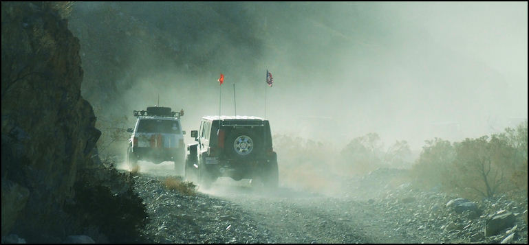
Photo: After airing down, we headed toward the first mine, on the dusty road. Just past the turnoff to the falls, the B.L.M. has posted a dire warning sign that advises that four wheel drive is required beyond the sign. It's true, but it's easy four wheeling, mostly Class-2, with a short section of easy Class-3.
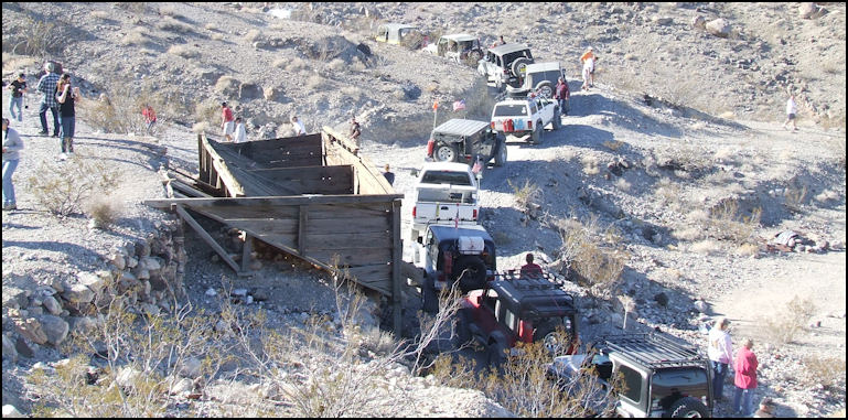
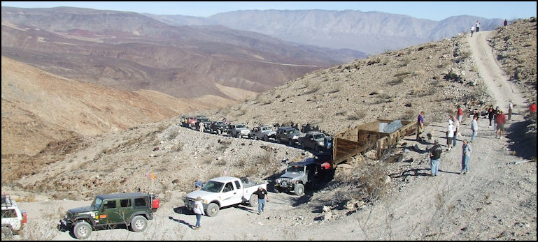
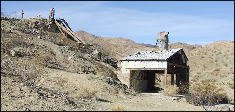
Photo: Stopped at the first mine, waiting for others in our group to join us. I took the opportunity to get out, stretch my legs, and snap a few photos. The trail climbs west into Darwin Canyon, and winds around the base of Zinc Hill. If you're a fan of old mining operations, you'll love this area, as the hillsides are dotted with the ruins of old mines, and gloryholes. There are many side trails of varying difficulty that lead to these mines - a person could spend all day exploring the area. But caution is strongly advised around old mines, as you always must STAY OUT OF OLD MINES, as they're geologically unstable, unsafe and highly dangerous. After a couple of miles of easy four wheeling, the run stopped at a old ore bunker, located next to the trail, and it was time to take our first break. Russell got on the C.B. radio and advised everybody to enjoy the scenery, explore the area, but to stay away from the old mine workings. This old mine operation was a fun place to explore, take photos and stretch our legs. In the area of this mine, several jeep trails can be seen that lead up the hill, towards the upper workings of the mine. We didn't drive any of those trails, as the logistics would have been nearly impossible with the forty or so vehicles that were in our entourage. This mine is located at elevation 3404 feet.
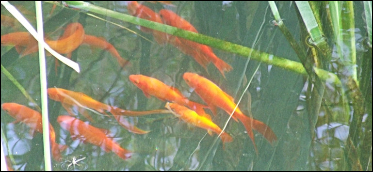
Photo: We had ample time to get outside and thoroughly explore the mine, and take lots of photos. After about three miles of mostly Class-2 four wheeling, with just a touch of easy Class-3, Darwin Summit, elevation 3760 feet is reached, and trail drops down into Darwin Wash. After an easy mile of four wheeling, we took a side road to the right - the road to Darwin is to the left, in order to visit China Garden Spring, with its famous koi pond. A koi pond in the desert? Yes, and its stocked with a couple dozen of bright-orange koi.
Photo: Looking north, from this interesting mine, with the Panamint Mountains in the distance, will give you an idea of how beautiful this country is. The white F-250 in the center of the photo is my rig. Our run leader announced that we were going to take our lunch break at the spring, since it was about 11:30, which isn't a bad time to eat lunch. I did a bit of post-run research and I found out that China Garden Spring got its name, as it was populated by many Chinese miners, who worked at the nearby mine, and as a side endeavor, planted vegetable gardens to sell vegetables to the hungry miners who lived at nearby Darwin. How the koi got there, I couldn't find, but I really wonder how much longer the Park Service will arrive the exotic fish to remain at the spring, as the Park Service have a problem with "exotic" species. Although this area officially is in the Darwin Falls Wilderness, it's administered by Death Valley National Park.
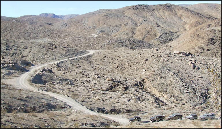
Photo: The trail through Darwin Canyon is mostly Class-2, but with a touch of easy Class-3 at the top of the pass, before descending down into China Garden Spring. Besides the exotic spring-fed koi pond, there's ruins of a mine, and a mill to explore. Not to mention that one of our group found the mummified remains of a coyote pup, which after word got around, really drew a crowd, including me, over to investigate. China Garden Spring is a very interesting place to explore.
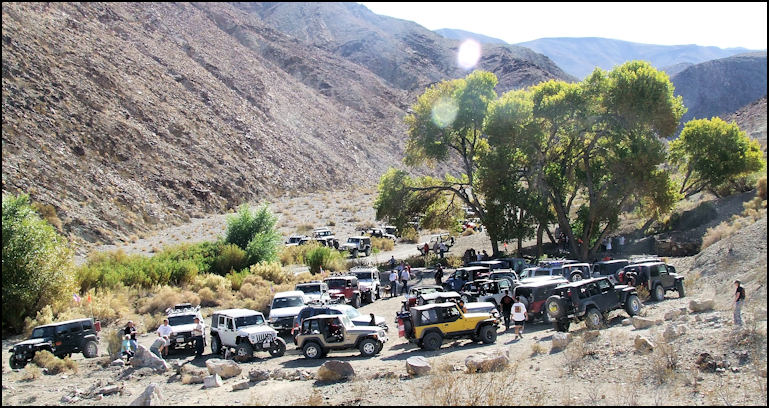
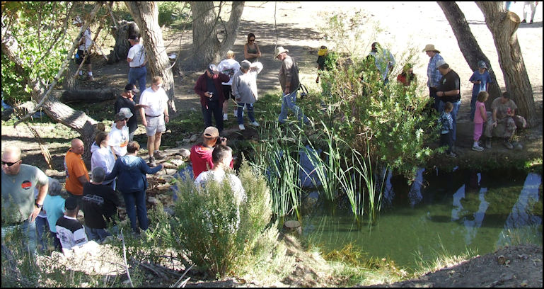
Photo: Our group is parked at China Garden Spring for lunch. The koi pond is shaded by the tall trees to the right of the photo. We left China Garden Spring, and backtracked the mile or so to the Old Toll Road, and then turned right, or geographically south. After a couple of miles, we passed Miller Spring, where a cluster of buildings remain from the days when there was a mill at this location that processed ore from the surrounding mines. Shortly after passing Miller Spring, we turned to the right on a semi-paved road that leads to Darwin, which is only about four miles away.
Photo: Members of our group take the time to admire the koi pond. One can only wonder how much longer the Park Service will allow this to exist, as they frown on exotic species. Darwin was named after Dr. Darwin French, who's expedition was searching for the "Lost Gunsight Mine" in the general area, in 1860. Silver, zinc, lead and other minerals were discovered in the area, and by the early 1870's a town was established. During the late 1870's, the population of the town was a couple of thousand hearty souls; today the population is less than 100, but the town still has a post office, and its own zip code, 93522, a general store, a dance hall, and more.
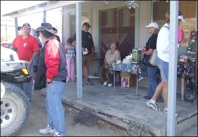
Photo: Brightly colored koi and goldfish, in a desert pond! Some of these fish are quite large; about 10" or so. The good folks in Darwin knew that we were coming, and they had prepared a sort of reception for us. On this early Saturday afternoon, the population of Darwin more than doubled when our 40 or 50 vehicles came into town and parked on Main Street, near the dance hall at the corner of Market and Main Streets. We parked on Main Street, and our entourage filled an entire block. The dance hall was set up as a flea market, with locally-made arts, crafts, and other items for sale. There were also refreshments available, which consisted of coffee, muffins, and several types of cookies.
Photo: Members of our group walk the dog, and admire the ruins of the mill, at China Garden Spring.
Photo: We've left Miller Spring, and are traveling to Darwin, on the semi-paved road. This road is actually listed as "Main Street," but we're still about 4 miles east of Darwin, when this photo was taken. We were treated to live entertainment with a distinctly local flavor... a rather interesting husband and wife team, performing such American classics as "Oh Susanna, Cotton Eyed Joe, and Turkey in the Straw." The wife played a 4-foot tall, twangy bow-like contraption that was attached to a galvanized wash tub, banged on the tub, with her foot for rhythm for rhythm, and attempted to sing harmony. Hubby played a harmonica, provided lead vocals, and blew on an empty bleach jug! Quite entertaining, but I'd truly advise these folks not to give up their day jobs...
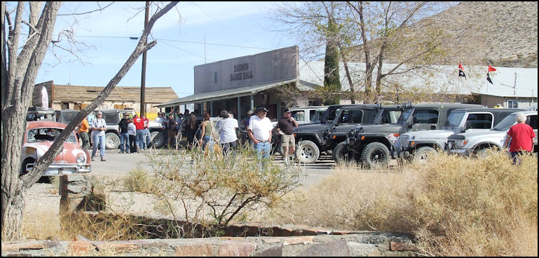
Photo: The Darwin Dance Hall, at Market and Main Street. For an hour or so, the population of Darwin quadrupled, when the gang from Panamint Valley Days came to town. I wanted to get back to camp early, since I planned to document the Saturday Night Barbecue Dinner, so I decided to leave and head back to base camp, as I'd already seen enough of the sights of beautiful downtown Darwin. Since I'd never been to Darwin before, I really didn't know how to get back to the highway, as Darwin is a little confusing. Sure, I could have asked directions, or wandered around, but I simply entered "Panamint Springs" into my Garmin GPS, and it effortless guided me to the highway.
Photo: Ma and Pa entertain a young admirer. Note Ma's interesting instrument, which makes a metallic, "twangy" sound. Pa alternates between singing, playing a harmonica, and blowing on the plastic jug. Darwin-style entertainment at its finest!
Photo: These entrepreneurs have coffee, cookies and crafts for sale to the crowd of four wheelers. The Back Door To Darwin Falls run was easy, fun, scenic, and suitable for any stock four wheel drive vehicle. Our run leader gave us ample opportunity to explore, stretch our legs, and enjoy the beautiful, desert scenery. If you like a relaxed, fun day, with a group of wonderful people, the Back Door To Darwin Falls is for you. It's another well-organized CA4WDC run, at Panamint Valley Days. Copyright(c) 2023 eRench Productions. All rights reserved. We've been on the web since December 22, 2002.
|