|
|
I
|
|
|
|
|
I happendrive a full-size 1997 Ford F-250 truck, and it serves me well for both a not-so-daily driver, a utility hauler, and last but certainly not the least, a vehicle to explore the great outdoors in. My truck is mostly stock, but I've made a few changes in the suspension, and have installed 32" BFG mudders, which are the tire of choice for many folks who like to four wheel in Panamint Valley, and other scenic areas in the great state of California. Although my truck isn't a daily driver, it's not a beater, so it's not something that I'd attempt the Cummins Cutoff run with, and if something happened to the truck, its a 388 mile walk from Panamint Valley base camp to our home in Roseville.
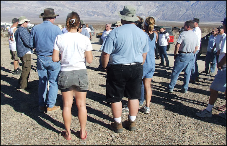
Photo: Friday afternoon driver's meeting, as our run leader Jesse May, at the far left of the photo, explains the rules, what to expect, and answers a multitude of questions. We were looking for a nice, easy run for Friday November 7, 2008, at CA4WDC's 23rd annual Panamint Valley Days, and the posted runs posted runs offered us a couple of choices: Jail Canyon, or Lookout City. Let's see, how many times have I been to Jail Canyon? ... so the Lookout City Sunset Run was our obvious choice. The run was an afternoon run, so it gave us all morning to sleep in, enjoy a leisurely breakfast at Chef Andy's, and for me, a chance to take a hike, and to take lots of photos around Panamint Valley Days base camp.
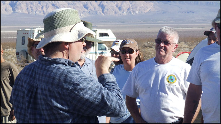
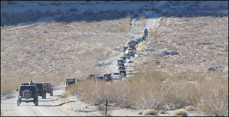
Photo: Jesse May makes a point to a couple of participants on the Lookout City Sunset Run. The customary driver's meeting for the run was held at 1:30 in the afternoon, on Slate Range Road, just north of base camp, as the run was to the north, and west of base camp. We met our run leader, Jesse May, who gave a bit of background information about the run, and explained trail ediquitte, and the do's and dont's of the run, especially the warning that NO DRINKING IS ALLOWED ON THE TRAIL. CA4WDC is very serious that all of their sanctioned runs are "dry," and if a driver is observed drinking, at a minimum, they'll be excluded from the run, and in some cases, law enforcement has been notified. This run seemed to be very popular, as there were probably about 40 vehicles participating on the run.
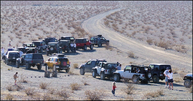
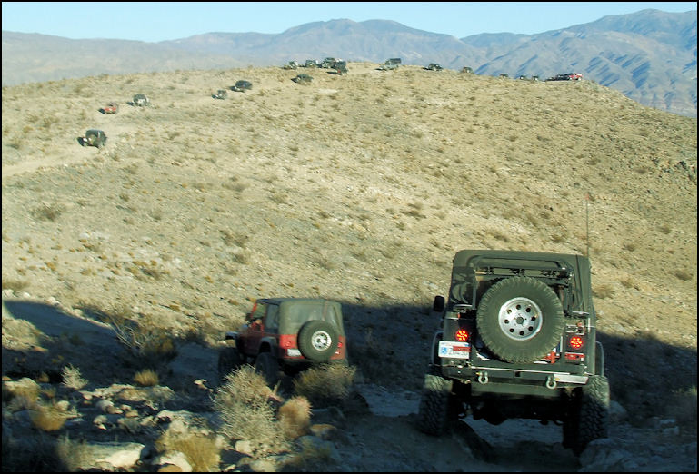
Photo: After turning off on the dirt Minetta Mine Road, we stop to air down, and take a break. That's the Class-1 Minetta Mine Road curving in the right of the photo. The run left base camp precisely at 2:00, with Jesse, as trail boss, in the lead, and headed east on Slate Range Road. It's a bumpy, washboarded, dusty three miles or so along of driving until you hit paved Panamint Valley Road, then it's about eight miles of pavement, until you turn off on the Minetta Mine Road, which is the road that eventually leads to Lookout City. Minetta Mine Road also serves as a gateway to the Defense Mine Run, and the grueling run via the infamous Cummins Cutoff, and in days gone by, it was your ticket to Stone Canyon. Minetta Mine Road is well signed, and its GPS coordinates from Panamint Valley Road are N36.14.947, W117.21.177, elevation 1736 feet. Just a couple of hundred yards onto the Minetta Mine Road, Jesse stopped the caravan to allow those who hadn't already aired down to do so. I had already aired down to 20 pounds per tire, back at base camp.
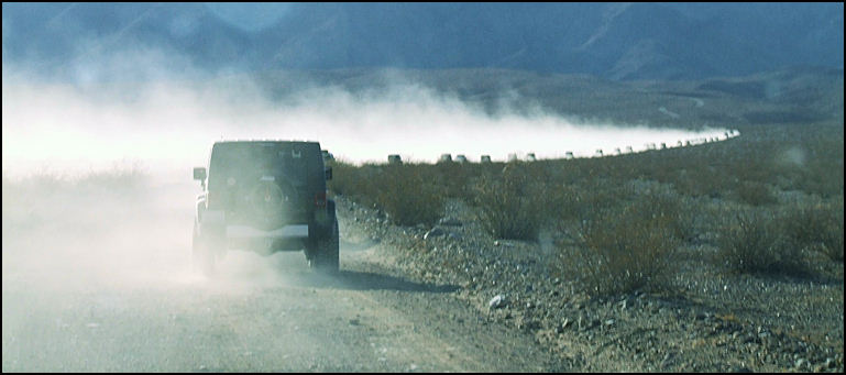
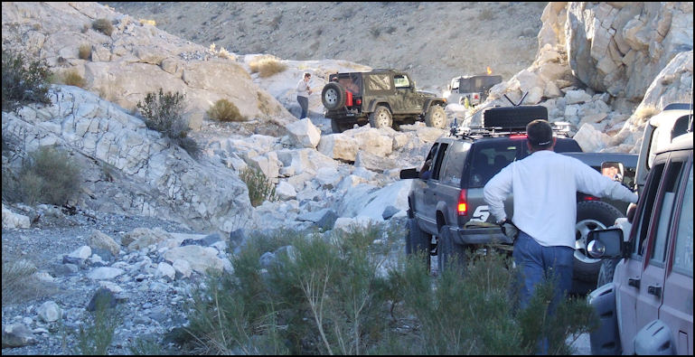
Photo: Do you like dust? This photo, taken out of the windshield of our truck, while we were in motion, shows how dusty the Minetta Mine Road can be, when you're towards the end of the pack. The Minetta Mine Road is a Class-1 road for about four miles, as it heads west toward the Argus Range. If you know where to look, you can see Lookout Mountain, as you drive the easy dirt road. Shortly after descending into a dry wash, and beginning a climb up an alluvial fan towards the Argus Range, the road narrows, becomes very rough, suddenly becomes a four wheel drive trail, that varies between Class 2 and Class 3 in difficulty. By the time the concrete slab of the once-substantial Modoc Mine (Minetta Mine is on the other side of the mountain) is reached, you're in four wheel drive, as the trail becomes steep and very rough. Just before the mine ruins, there is a very sharp, 90-degree turn in a small wash, which can prove quite interesting for a full-size vehicle, but we didn't experience any difficulty.
Photo: The lead vehicle is beginning to climb the alluvial fan, and the trail has already become Class-2; time to engage four wheel drive. Past the mine ruins, the trail becomes increasingly steep, as heads up the alluvial fan, passes an old ore bin, and enters a canyon. Soon the trail becomes very steep; a very difficult Class 3, and the canyon narrows. We weren't experiencing difficulty in our almost-stock F-250, negotiating the rough trail, and keeping up with the pack, but I remarked to Sharlene that if the trail became any more difficult, we'd have to park, and terminate our participation in the run. I've been four-wheeling long enough to know the limits of my vehicle. I don't relish the idea of turning around, but after my nasty experience in the Inyo Mountains, back in July, 2004, I have a lot of respect for trails.
Photo: I didn't want to negotiate the rock garden, just to the rear of the Jeep in the center of the photo, that he just climbed, so I parked the truck at the side of the trail. About a mile into the canyon, I came to my waterloo, as we approached a small waterfall, and I watched the Jeep Rubicon ahead of me approach it, and negotiate it easily, but I could see this obstacle wasn't for us. Sure, we could have made it, but at what cost? Would it be worth it? So I parked the truck at a wide spot in the trail, and watched others climb the waterfall.
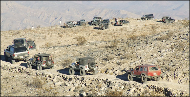
Photo: No, we're not at Lookout City, as the lead vehicles are taking a break. Note the original engineering work on the trail, which dates to the 1870's, and has outlasted the town. The folks directly behind me, Danny and Linda Ward, in an awesome Jeep Rubicon, stopped and asked us if we were ok. I told them that we were, but we didn't feel comfortable climbing the waterfall in our truck, and we were going to wait for everybody to pass, and then head back to camp. They asked us if we'd like to ride with them to Lookout City, and I replied that I didn't want to impose, but they said it wasn't any problem and that they'd be glad to give us a ride. As they spoke, Linda jumped in the back seat, and I protested, as I offered to ride "shotgun" in the back seat, but Linda said she was smaller and was happy to ride in back. They had only one available seat, so I jumped in the front seat, and Sharlene jumped in with their buddy Pete, who was in the Jeep behind the Wards.
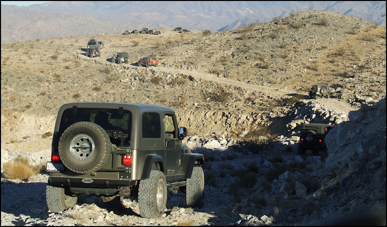
Photo: The trail to Lookout City switchbacks up Lookout Mountain, and is very scenic, and a lot of fun. Shortly after the waterfall is climbed, there's a fork in the trail. The left fork switchbacks up a mountain and leads to Lookout City, and the right fork heads to the Cummins Cutoff, Defence mine, and the now-closed trail to Stone Canyon. We played the follow-the-leader game by taking the left fork, and switchbacked up the steep trail toward our destination of Lookout City.
Photo: The Jeep in the foreground is negotiating a small, Class-4 "bump in the road" which is the final obstacle to Lookout City. The trail up winds up Lookout Mountain to Lookout City, and it is narrow, steep, and a lot of fun. The trail clings to the side of the mountain, so alternating between your left and right sides, you're afforded outstanding views of Panamint Valley, the distant Panamint Range, and the trail below you. If you're afraid of heights, this trail isn't for you, but if you love desert scenery and breathtaking drop-offs, this is your trail. On the drive up, the Wards and I talked about the difficulties the old timers must have had not only building the trail, but getting wagons and stage coaches up and down the trail. In the 21st century, climbing the trail in a well-equipped Jeep Rubicon, we have it easy! It's about two miles to the top of the hill.
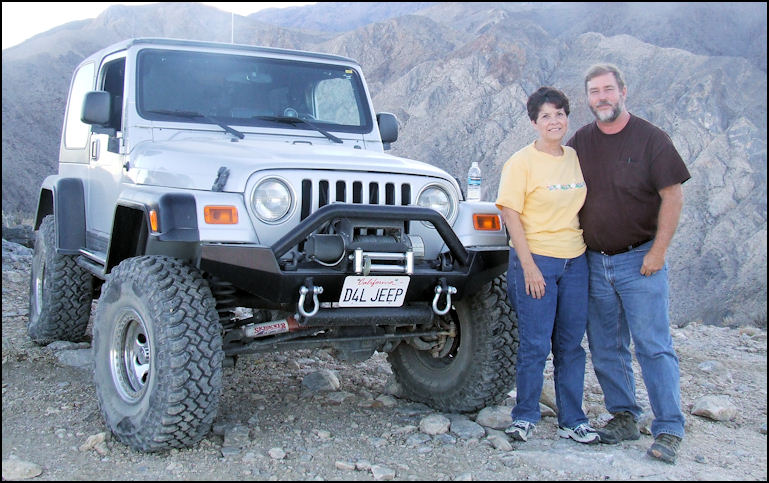
Photo: Danny and Linda Ward pose in front of their awesome Jeep Rubicon, at Lookout City. They were truly good Samaritans, and it was wonderful of them to give me a ride up the mountain, after I'd parked our truck. Near the top of the trail, there are a couple of rocks to negotiate, which amount to a Class-4 obstacle, then it's actually downhill a half mile or so to what's left of Lookout City. The city itself is in ruins, as only rock foundations and tin cans remain, but the breathtaking view hasn't changed. When I last visited Lookout City, back in 1997, there was still quite a bit of lumber remaining, along with old bottles, and rusted mining equipment. In 2008, all of that has disappeared, due to time, weather, and vandals.
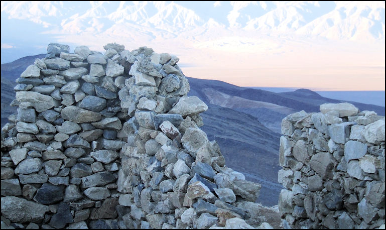
Photo: The foundation of the Lookout City hotel, and the Panamint Range in the background. Little remains of Lookout City. Lookout City was active in the 1870's, as a silver mining town, and during that time boasted 30 or 40 houses, a couple of general stores, livery stables, several saloons, and a substantial hotel, who's ruins remain visible today. The town boasted a couple of ore reduction furnaces, and wood was obtained from Wildrose Canyon, across Panamint Valley. The piñon pine wood was cut, and burned into charcoal at the Charcoal Kilns, in Wildrose Canyon. I find it interesting that thousands of people visit the Charcoal Kilns annually, and only a handful visit Lookout City, which the furnaces of Lookout City are the reason for the existence of the Charcoal Kilns. As an aside, we took a trip to the Charcoal Kilns two days later, after a snow storm, so you might want to check out that article.
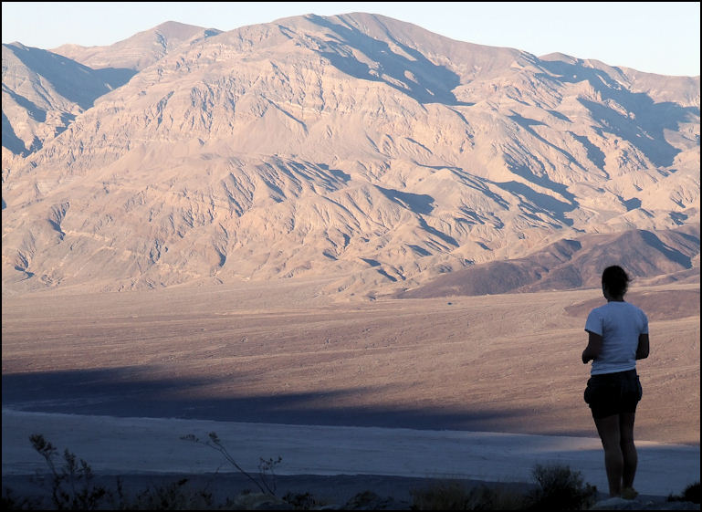
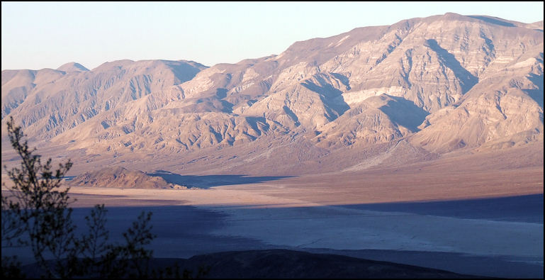
Photo: Looking northeast from Lookout City, at four in the afternoon, as the sun begins to set, on this mild November afternoon. Lookout City is perched on top of Lookout Mountain, at an elevation of 3708 feet, and affords an outstanding view of Panamint Valley, and the Panamint range to the east, hence the name. GPS coordinates are N37.14.548, W117.25.945. At the time of our visit, the weather was sunny, and the temperature about 60 degrees. The view was outstanding, as we could see north from Hunter Mountain and the Panamint Dunes, south to the Slate Range, and beyond.
Photo: Looking northeast, the small hill in the middle of the valley is Lake Hill, and if you look up the alluvial fan to the east, you can see the wash that leads to the Big Four Mine. Cameras were produced, ice chests opened, and tops were popped on cans of soda, as folks hiked around the ruins, ooooohing ahhhhhing over the spectacular view. The sun was setting over the Argus Range to the west, which cast Panamint Valley, to the east, in a golden, mellow light, which offered great photo opportunities. After a half hour or so on the mountain, it was time to head back to base camp.
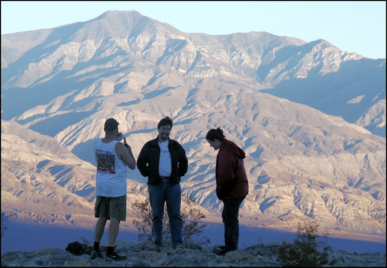
Photo: I wonder if this trio is aware that they're providing foreground material for soaring Telescope Peak, in the background, at elevation 11,331 feet, is the highest point in Death Valley National Park, and the Panamint mountain range. The drive down from Lookout City is easy, and since gravity is on your side, four wheel drive is only needed as a brake, to keep your speed under control. After effortlessly negotiating the dry waterfall that stopped me, the Wards dropped me off at our truck, and said a cheery farewell. I profusely thanked them for their generosity, and Sharlene did the same to Pete, who had graciously taken her to Lookout City. Pete and the Wards are great people, and typical of the quality of folks who participate in Panamint Valley Days, and other CA4WDC sanctioned runs. The ride back to camp was easy, and we arrived shortly after six in the evening, well past dark, but with ample time to power down a few beers, and enjoy a fine dinner of rotisserie chicken, with all the fixin's, at Chef Andy's Ruff Rock Run Café.
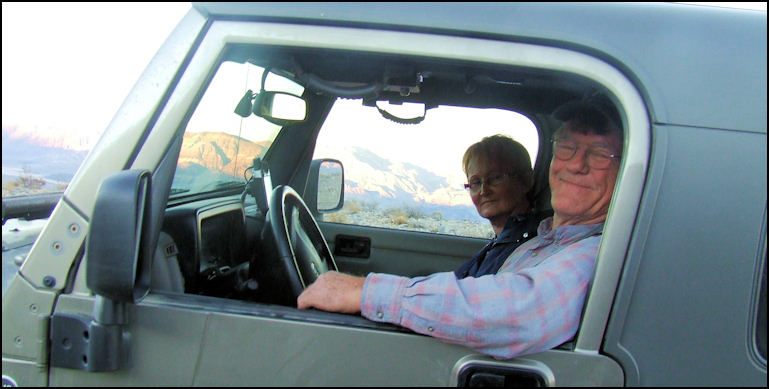
Photo: Pete, Sharlene's ride, and Sharlene pose for the camera, as we pull aside them, on the way down from Lookout City.
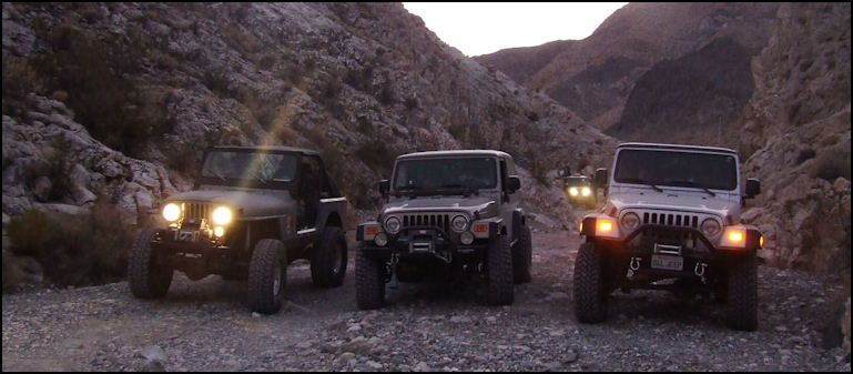
Photo: It's nearly dark, Sharlene and I are back in our truck, and I just have to snap a photo of three awesome Jeeps, just after sunset. Thanks to the generosity of our new-found friends, Sharlene and I enjoyed a wonderful day on the Lookout City run at Panamint Valley Days, 2008. Copyright(c) 2023 eRench Productions. All rights reserved. We've been on the web since December 22, 2002.
|